Quick Help
Compatibility/Notes
This site should be compatible with most modern browsers. It is not compatible Internet Explorer (any version). Also we require the use of JavaScript for many of our functions.
The instructions here refer to the Left Side and the Right Side. That is for the desktop version of the site. Mobile devices and devices with smaller screens adjust to fit in the display. Though the layout changes, much of the information still applies.
Left Side
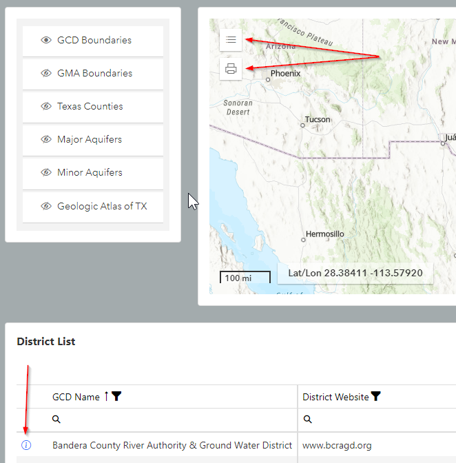
On the left side of the web page we have the Map Layer Control on the far left. To the right of that, is the Map. There are some interactive "widgets." In the top left of the map are the Legend widget and the Print widget. Clicking either will open up the control so you can make choices. The Layer Control will allow you to turn on or off the layers you choose. The Print widget will allow you to print what is currently on the map.
Beneath the Layer Control and Map is the District List. By clicking the various column headers you can change the sort method as you see fit. The funnel icon will allow you to filter the results by choosing different conditions. The magnifying glass directly beneath each header will allow you to search that column for a particular string. On each row, clicking the blue "i" circle icon will open a separate window or tab displaying that District's information.
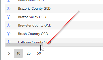
At the bottom of the list are paging controls for navigating the list. On the left are the options for the number of rows to display per page. On the right is for navigating page-by-page. Also, if you hover your mouse pointer near the bottom of the list, a horizontal scroll bar will appear. This will allow you to scroll to the right to see the other columns.
Right Side
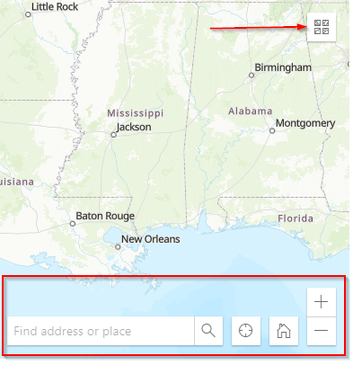
On the right side of the web page we have additional widgets for the map. In the top right of the map is the Base Map widget that allows you to choose a different style of base map. Further down are the Address/Place Search widget. Next to it is the Locate widget that will try to pinpoint your location on the map; the Home Position widget will recenter the map; and the Zoom In and Zoom Out buttons. Note: You can also zoom in or out with a mouse wheel or by clicking and dragging your mouse over an area of the map.
At the top right of the District list there is a button to export the data in the list to an Excel file. Also there is another search field here. It is different from the column header search fields in that it will search all the columns at once.
The table of districts is very wide. Near the bottom of the table will be a horizontal scrollbar. This will allow you to scroll to see the other columns.